![]()
QGIS is a free and open-source geographic information system used to create, edit, visualize, analyze and publish geospatial information. We are going to use QGIS to make a world cities map visualization using our free world cities database.
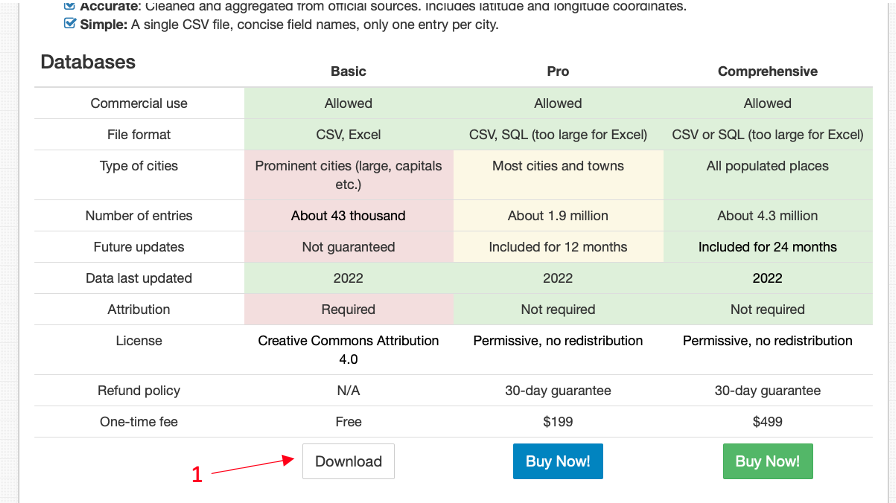
Download our free basic World Cities Database CSV file
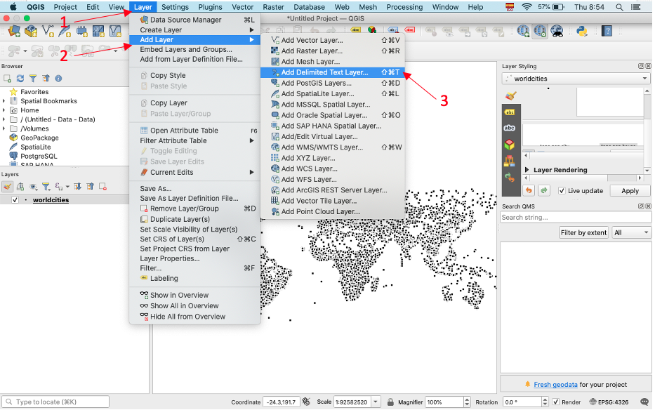
Open QGIS. Go over to the Layer menu and add a Delimited Text Layer
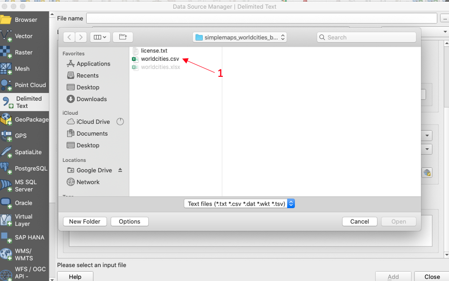
Select the file "worldcities.csv".
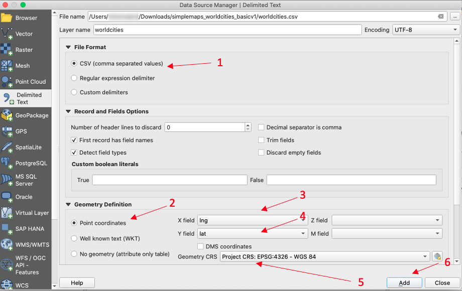
Now, let's set up the input configuration for our data. In the file format block select "CSV". Go to the Geometry Definition section and select "Point Coordinates". In the data file, we use the "Ing" column for X values and the "Lat" column for Y values. Last, for the Geometry CRS select "EPSG:4326" and click "Add".
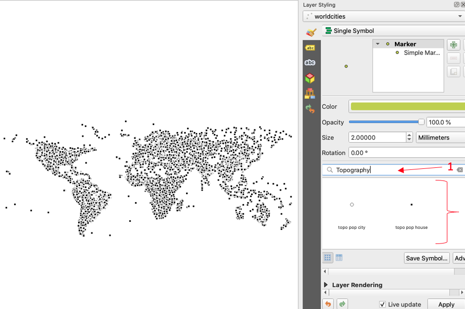
You should be able to see the visual projection of the world cities database by now. On the left side, over in Layer styling, you can select the type of marker you want to use.
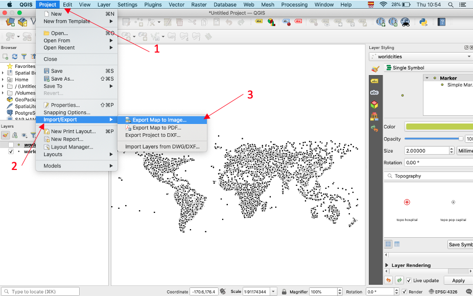
Finally, to save the data visualization image, go to the "Project" menu and select the "Import/Export" option. Click "Export Map to Image".
Home (Maps) | Database License | Privacy | Database Releases | Database Order Lookup | Resources | Contact | FAQs
SimpleMaps.com is a product of Pareto Software, LLC. © 2010-2024.