

We're so confident in the quality of our map that we offer a full 30-day money-back guarantee. If the map doesn't work out for you we'll happily refund your money.


Customize maps by editing an online spreadsheet or simple text file. No knowledge of HTML5 or JavaScript is required. Step-by-step documentation makes installation painless.

Our HTML5 maps look gorgeous on iPhones, Android devices and iPads. Our responsive maps automatically detect mobile devices and adjust navigation to be touch friendly.

Get fast answers from the one of the map's developers. We're happy to troubleshoot any installation or customization issues that arise. Just ask!

Add location markers to the map using only latitude and longitude. Choose shapes or images. Easily customize the size, color, and description.

States can act as links. Click on a state and go to a specific url. Use the map to simplify your websites user interface.

Almost every aspect of the map can be customized. Colors, descriptions, links, labels, locations, regions and much more.
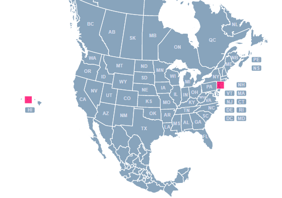
This map includes the following states and provinces:
{
  AB: "Alberta",
  AK: "Alaska",
  AL: "Alabama",
  AR: "Arkansas",
  AZ: "Arizona",
  BC: "British Columbia",
  CA: "California",
  CO: "Colorado",
  CT: "Connecticut",
  DC: "District Of Columbia",
  DE: "Delaware",
  FL: "Florida",
  GA: "Georgia",
  GU: "Guam",
  HI: "Hawaii",
  IA: "Iowa",
  ID: "Idaho",
  IL: "Illinois",
  IN: "Indiana",
  KS: "Kansas",
  KY: "Kentucky",
  LA: "Louisiana",
  MA: "Massachusetts",
  MB: "Manitoba",
  MD: "Maryland",
  ME: "Maine",
  MI: "Michigan",
  MN: "Minnesota",
  MO: "Missouri",
  MS: "Mississippi",
  MT: "Montana",
  Mexico: "Mexico",
  NB: "New Brunswick",
  NC: "North Carolina",
  ND: "North Dakota",
  NE: "Nebraska",
  NF: "Newfoundland",
  NH: "New Hampshire",
  NJ: "New Jersey",
  NM: "New Mexico",
  NS: "Nova Scotia",
  NT: "Northwest Territories",
  NU: "Nunavut",
  NV: "Nevada",
  NY: "New York",
  OH: "Ohio",
  OK: "Oklahoma",
  ON: "Ontario",
  OR: "Oregon",
  PA: "Pennsylvania",
  PE: "Prince Edwards Island",
  PR: "Puerto Rico",
  QC: "Quebec",
  RI: "Rhode Island",
  SC: "South Carolina",
  SD: "South Dakota",
  SK: "Saskatchewan",
  TN: "Tennessee",
  TX: "Texas",
  UT: "Utah",
  VA: "Virginia",
  VI: "Virgin Islands",
  VT: "Vermont",
  WA: "Washington",
  WI: "Wisconsin",
  WV: "West Virginia",
  WY: "Wyoming",
  YT: "Yukon"
}
Does the map work on iPhones and iPads?
Yes! It does.
Does the map require jQuery or other dependencies?
No. The map does not use any jQuery and it won't interfere with jQuery or other common libraries you may be using on your page.
Does this map use Adobe Flash?
No, this map replaces the Flash North America map that we used to sell. At this point, Flash is a dying technology and we have deprecated our Flash maps.
What browsers are supported?
Chrome, Firefox, Safari 3.2+, iOS Safari 3.2+, Opera, Opera Mobile, Internet Explorer 7+, Android Browser 3+, Android Chrome and more.
Is it possible to split states/provinces?
Yes, although this requires a little bit of work. We can do this for you for $15 per state. Or, if you are technically inclined, you can follow these instructions
Is it possible to hide Mexico?
Yes, just add hide: 'yes', to Mexico in the mapdata.js file and then adjust the initial view of the map. Contact us for help.
Is it possible to add provinces to Mexico?
Yes, we have a special version of the North America map that includes Mexico's provinces. There is no additional charge for this version. Click here to customize this version.
Home | License | Privacy | Releases | Testimonials | Resources | Documentation | Order Lookup | All Maps | FAQs
Formerly FlashUSAmap.com and FlashWorldMap.com
SimpleMaps.com is a product of Pareto Software, LLC. © 2010-2026.